
 : 31 Oct 2026 , Academician Dobretsov: On the Crest of the Plume , volume 72,
N2
Academician Dobretsov: Ideas and People
The name of Academician Nikolai L. Dobretsov needs no introduction. A renowned Russian geologist, the founder of the Siberian school of deep geodynamics, and a distinguished organizer of science, he was the long-standing editor-in-chief of SCIENCE First Hand from 2004 to 2020 and the author of popular science articles and commentaries on the most pressing scientific and sociopolitical issues from the state of academic science in Russia to global climate challenges. Written for his milestone birthday and described by the author as a blend of science and memoir, this work holds a special place in his oeuvre. Dobretsov discusses new methods for studying the evolution of the Earth’s crust, gives a historical overview of this line of research, describes his own contribution to the field, and pays tribute – with respect and affection – to all those who accompanied him on his path: his family, friends, teachers, colleagues, and students
This article by N.L. Dobretsov (1936–2020)
was first published in Russian and English
in the journal SCIENCE First Hand in 2016
The text you are reading, a blend of science and memoir, gives several illustrations of one simple thought: ideas are inseparable from particular people. They emerge from debates and collisions of personalities and live on as long as there are students to uphold and develop them.
I will begin with current times and ideas of recent origin. People of a certain age often ponder the meaning of life, so I find myself increasingly drawn to global ideas and generalizations. Accumulating experience and passing it on to the younger generation – this, too, constitutes the meaning of life.
Tectonic “necklace” of the Pacific Ocean
Lately, I focused my attention on the study of geological structures visible on gravity maps derived from the international satellite telemetry datasets published in 2014. These maps reveal hidden geological structures, which could tell us a great deal about the history and evolution of the Earth’s crust.
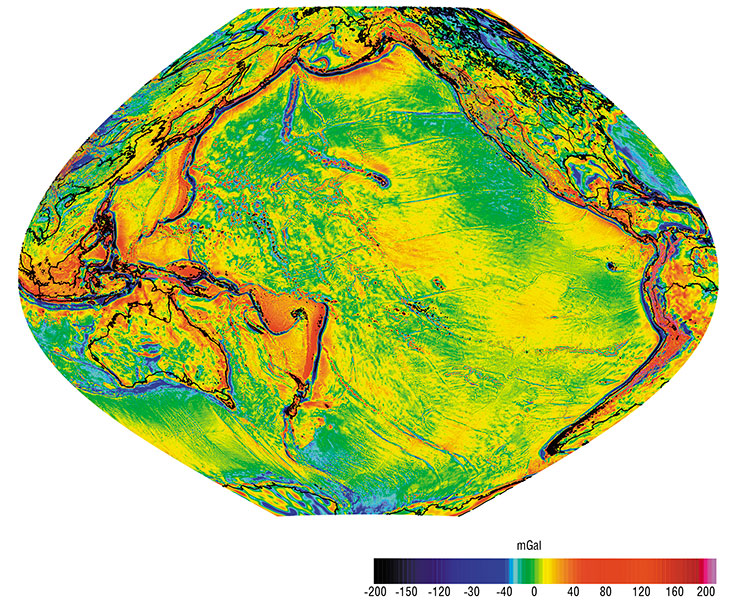
It was Alexander N. Vasilevsky who drew my attention to the new information derived from the global satellite-based gravitational anomaly maps. This happened after I joined the seismic tomography laboratory, headed by Ivan Yu. Kulakov. A relatively young scientist, he had nonetheless emerged as a central figure in Russia in the development of seismic tomography algorithms.
The oceans’ most striking features are associated with deep-sea trenches and subduction zones, where one lithospheric plate dives beneath another. There are three fascinating structures in the Pacific that serve to illustrate the use of gravity data for tectonic reconstructions (see the map of the Earth’s Pacific segment prepared by Vasilevsky at my request).
The gravity anomalies in the eastern Pacific clearly reveal spreading centers, i. e., areas where lithospheric plates diverge and new lithosphere emerges. These areas coincide with mid-ocean ridges, i. e., linear, extensive seafloor uplifts. In the eastern Pacific, these ridges lie close to the continent and exhibit complex geometries. For instance, the East Pacific Rise “dives” beneath the North American continent in the Gulf of California and “reemerges” north of the Mendocino Transform Fault, near the US–Canada border, as the Juan de Fuca Ridge. The gravity maps show a characteristic ripple pattern oriented transverse to the ridges, which appears to be due to convective currents in the asthenosphere beneath the ocean floor at depths of 10–50 km.
In the northwestern Pacific, gravity anomalies reveal traces of massive volcanic eruptions that occurred between 150 and 90 million years ago. The map displays distinctive radial–ring structures associated with eight uplifts and oceanic plateaus. These uplifts are essentially vast fields of extruded magma up to 1000 km in diameter and several kilometers thick, which were formed by the surface emergence of plumes, i. e., colossal mantle jets rising from the core–mantle boundary. The morphology and evolution of these features are detailed in a recent monograph by Richard E. Ernst (2014).
In this same part of the Pacific, we can clearly trace a long chain of islands extending from the Hawaiian Islands to the Emperor Seamounts, where the Kamchatka and Aleutian trenches meet. These islands resulted from the Hawaiian plume – a persistent, narrow, hot mantle jet – “piercing” through the moving oceanic lithosphere. The gravity anomalies reveal evidence of the varying nature of volcanic activity in different sections of the chain. For instance, the Pacific Plate was moving due north during the formation of the ridge’s oldest segment between 83 and 45 million years ago. The eruptions during this period were explosive, ejecting large volumes of pyroclastic material around the volcanic islands. During the second phase, a relatively short one spanning from 45 to 40 million years ago, the Pacific Plate underwent a sudden reorientation toward the northwest. Meanwhile, the pattern of the gravity anomalies indicates that explosive eruptions gave way to calmer magma outpourings without long-distance ash ejections. Subsequently, the plate changed its direction once again, now to a roughly east–west trend, as evidenced by the orientation of transform faults and – only partially – by the Hawaiian plume trail, as the plume itself was shifting southward. The volcanism pattern fluctuated several times during this phase, ranging from explosive to relatively quiescent. Nowadays, Hawaiian eruptions are considered a classic example of effusive outpourings.
The above examples demonstrate that the gravity map of the Pacific Ocean serves as a clear illustration of the interplay between plate tectonics and plume tectonics. I had participated in the development of this idea since 1980s, for which I received Russia’s State Prize in 1997 as part of a team of authors.
A new aspect emerging from the analysis of the satellite-based gravity anomaly map of the Pacific sector is the idea of periodic global reorganizations leading to abrupt changes in the direction of motion of lithospheric plates. The cause of these reorganizations remains unclear. They may be due to interactions between convective flows in the asthenosphere (at depths of 100–400 km) and mantle plumes. Naturally, it was not only the gravity map that informed these conclusions but also a wealth of other evidence, including data recently presented by Ernst at his lectures at Novosibirsk State University.
Evolution of Kamchatka’s lithosphere
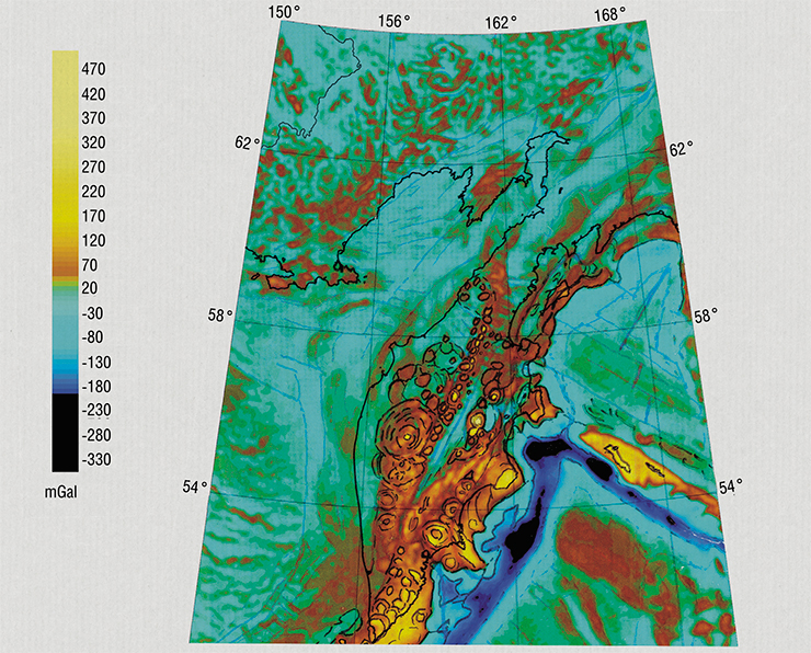
Using the gravity anomaly map in the Faye reduction generated from the same telemetry datasets, we were able, for the first time, to reconstruct the tectonics of major geological reorganizations in the Kuril Kamchatka and Aleutian regions.
An enlarged map fragment showing Kamchatka and adjacent areas reveals structural features of the Sredinny Range and the Eastern Belt, which encompass the region’s major volcanic complexes. Large oval structures mark the sites of massive explosive eruptions, i. e., calderas. In Western Kamchatka, across the Koryak Isthmus, and within the Sea of Okhotsk, one can trace structures associated with the ancient subduction zone of the Kronotsky–Karaginsky Arc, which collided with Kamchatka 7 to 10 million years ago. The gravity map also reveals the pattern of the spreading of the Komandorsky Trough, located behind the Komandorsky Islands, which was active 7 million years ago.
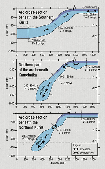
To understand the complex geological processes in the Kuril–Kamchatka and Aleutian regions, we used seismic tomography data on the deep structure of the mantle, which were obtained by Kulakov’s team.
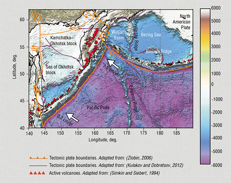
As is known, the Pacific Plate, moving at a speed of 7.5–8.2 cm per year, begins to subduct beneath Kamchatka and the Kuril and Aleutian Islands within the zones of so-called deep-sea trenches. At depths of 100–150 km, the plate melts, releasing plenty of fluids, which results in the formation of regular chains of volcanoes on the surface. Seismic tomography allowed us to trace the path of the oceanic plate as it descends into the mantle at various sections of the arc and to assess the forces governing the subduction process.
For example, the slab under the Southern Kuriles becomes flatter at a certain depth while its thickness increases noticeably, suggesting that its movement is slowing down to 3–4 cm per year. This behavior is possible in the case of “pushing” from the part of the oceanic plate that has not yet submerged. A completely different mechanism is observed in the northern part of the arc beneath Kamchatka. The corresponding cross-section shows that the slab material forms a huge “droplet” at depths from 400 to 850 km, and above it the slab thins, as if a droplet of viscous honey is coming off. Evidently, what powers this process is that the heavy “droplet” drags the whole slab down. Under the northern Kuril Islands, we see an intermediate variant, i. e., both a droplet and a thickening at the beginning of the movement of the slab.
Dating of the oldest volcanic rocks found on Kamchatka revealed an age close to the time of rotation of the Pacific Plate, which occurred 43 to 45 million years ago. Other near-north–south trending subduction zones in the northwestern Pacific also formed during this period, which coincided with the cessation of older oblique and near-east–west striking arcs (with the exception of the eastern Aleutian Arc). Another rotation of the Pacific Plate, which occurred about 20 million years ago, was likewise accompanied by major tectonic reorganizations: the opening of back-arc basins (such as the Shikoku and Japan Sea basins and the South Kuril and Komandorsky depressions), the formation of the West Philippine subduction zone, and structural changes in the Tasman Sea and adjacent arcs. This is hardly surprising as the rotation of a giant plate like the Pacific one reflects a reorganization of the entire or most part of the convection cell system within the asthenosphere.
Kamchatka story
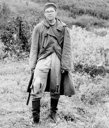
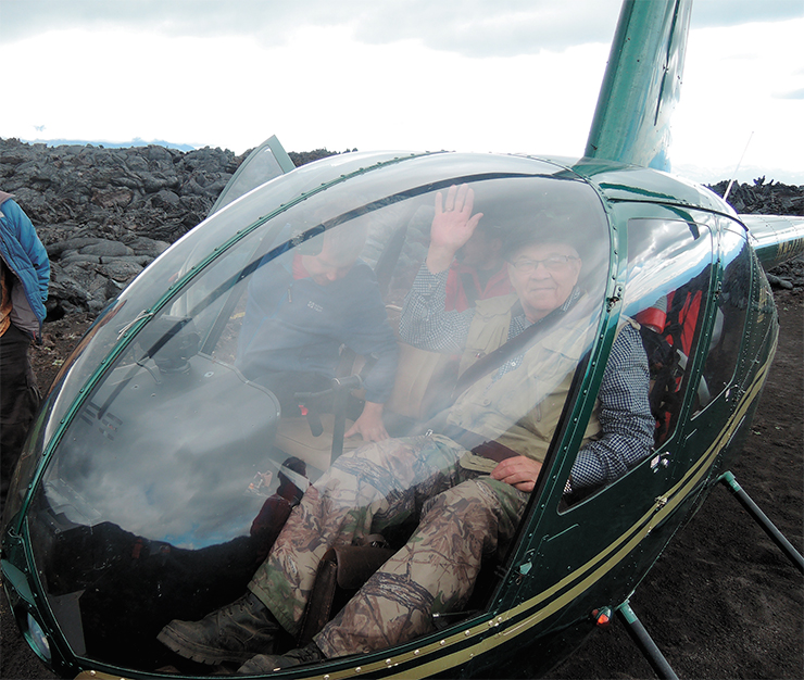
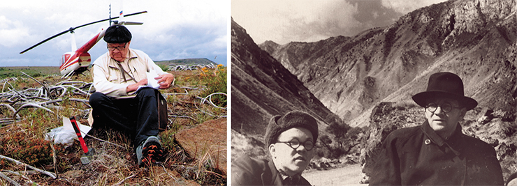
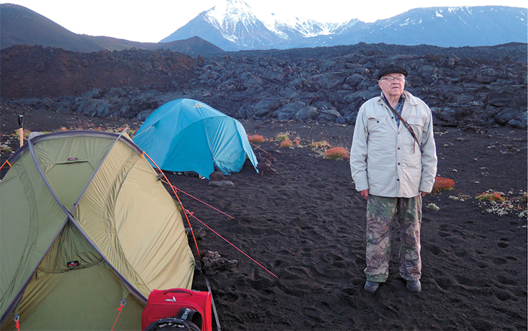
I conducted eight field seasons of varying lengths in Kamchatka. I first worked there – in the northern Koryak region – in 1964–1965. Back then we had no helicopters; on very few occasions, we could use horses, so we mostly traveled on foot, to the point of exhaustion, as the photograph shows.
What kept drawing me back to Kamchatka time and again? Family tradition played a part. After being arrested in 1906 for involvement in the revolution, my maternal grandfather, Nikolai G. Kell, went to Kamchatka; he worked there from 1908 to 1910 as part of the expedition funded by the merchant Fyodor P. Ryabushinsky. My mother was born there in November 1909.
My grandfather, together with the geologist Sergei A. Konradi, made the first map of Kamchatka’s volcanoes, but the war and the ensuing devastation prevented its timely publication. Eventually, the map was published in 1928 by the Pacific Committee of the USSR Academy of Sciences and the Russian Geographical Society.
After his trip to Kamchatka, my grandfather resumed his studies at the Mining Institute in 1910. Upon graduating in 1915, he worked as an assistant to plant superintendent and a government assayer at a precious metals refinery in Yekaterinburg. In 1919, he became the first elected rector of the Ural Mining Institute; from 1920 to 1921, he served as director of the Mining Institute at Ural State University, and from 1921 to 1922, as dean of the Department of Geological Prospecting. In late 1922, he returned to the Mining Institute in Leningrad; in 1923, he was elected head of the Department of Geodesy, a position he held until 1953.
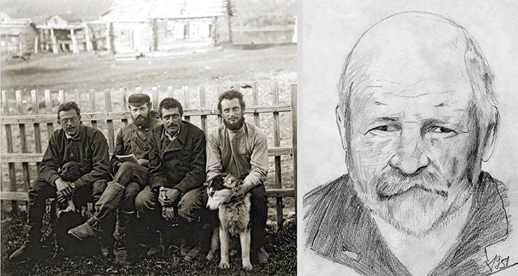
My grandfather played a major role in my life. I always sought to follow his principles, one of them being: “Focus not on fighting the bad but on supporting the good.”
It was he who initiated my move to Siberia. I had already graduated from the Mining Institute when the Party’s Central Committee and the Council of Ministers issued the decree on the establishment of the Siberian Branch of the USSR Academy of Sciences. My grandfather called me in and said, “I see that you are thoughtful and inquisitive. But this city is full of your type. Go to Siberia. There’s a whole new thing there, a good chance for you to make you mark.” And that is exactly what happened.
The next link in the Kamchatka history of the Kell–Dobretsov family was my mother, Yulia N. Kell (Dobretsova). She was born in Kamchatka and, like Kell’s other children, graduated from Leningrad Mining Institute. In 1931 she spent a field season working in Kamchatka at the Avacha volcano. At that time she was a postgraduate student under Prof. Alexander N. Zavaritsky (who would later become an academician).
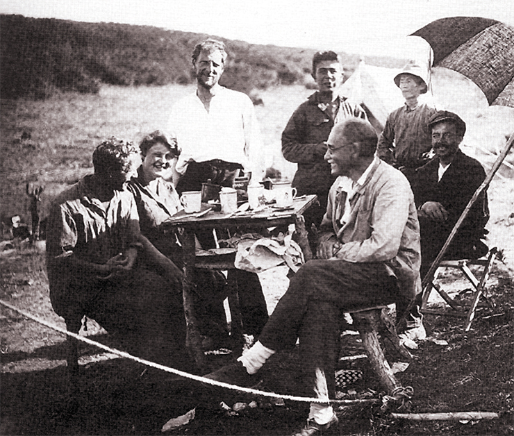
While on Zavaritsky’s expedition team, she met my father, Leonty N. Dobretsov, a physicist from Leningrad, who was working at the State Optical Institute under Academician Dmitry S. Rozhdestvensky. I have no idea what had brought him all the way to Kamchatka. Nonetheless, he and my mother met there and, after weathering numerous hardships, got married upon their return to Leningrad (I published my parents’ recollections alongside my own in 2003 and 2010). My older brother Georgy (whom we called Egor) was born there the following summer, and then was I in 1936.
My father was an outstanding scientist and a wonderful person; he had come to Leningrad from Veliky Ustyug and graduated from Leningrad University. He was a researcher and professor, a student of Academician Abram F. Ioffe, the “father” of nearly all Soviet physicists, and one of the teachers of Nobel laureate Academician Zhores I. Alferov. In 2004, Academician Alferov organized commemorative events at the Physical–Technical Institute in St. Petersburg to mark the centenary of my father’s birth; most of the Dobretsov family attended, and afterwards, my sister Olga Egorova hosted a celebratory dinner at her home. My father taught me the most important lesson: be faithful to science and the principles of scientific inquiry. From my mother, I learned devotion to family and family values.
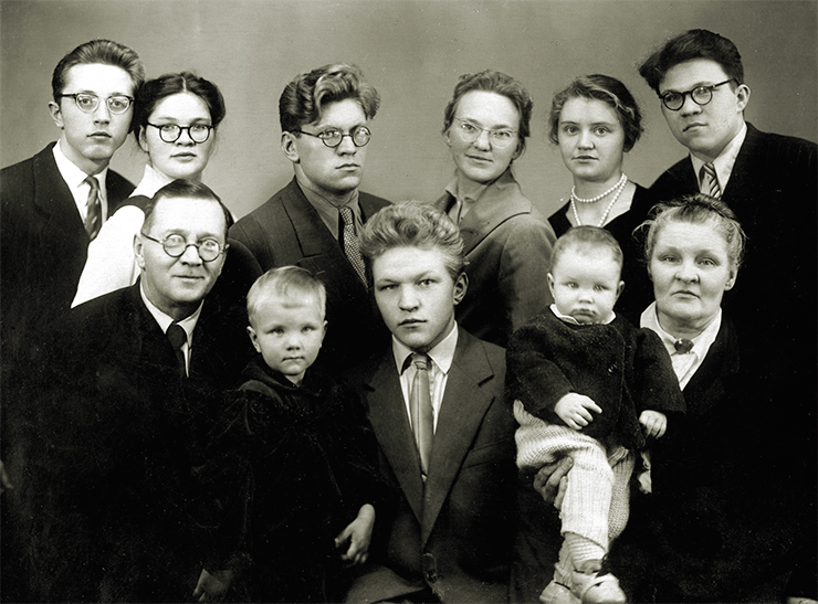
The foundation for five generations of the Kell–Dobretsov family was Leningrad (St. Petersburg) Mining Institute, established by decree of Empress Catherine. Nikolai G. Kell – my grandfather – entered the institute in 1903 and graduated only in 1915 after seven years of “adventures.” From 1923 until his death in 1966, he headed the Department of Geodesy (becoming a professor there in 1953), and in 1946, he was elected a Corresponding Member of the USSR Academy of Sciences. His major achievement was the introduction of the Gauss–Krüger rectangular coordinate system in the Soviet Union. His younger brother, Georgy G. Kell, graduated from the St. Petersburg Mining Institute in 1911 and worked on expeditions organized by Geolkom (the Geological Committee), including in the Altai region. He passed away at a very early age (in 1919). In an obituary, Sergei S. Smirnov (who would later become an academician) spoke very warmly of G. G. Kell and his principal endeavor, i. e., the Mining Exploration Bureau. All of N. G. Kell’s children graduated from the Mining Institute in the 1930s, and his son, Lev N. Kell, was a longtime rector of the institute (1964–1978). Five of N. G. Kell’s grandchildren, including myself and my brother Egor Dobretsov as well as my cousin Sergei Kell, graduated from the Mining Institute in the 1950s and 1960s, and so did subsequently several of N. G. Kell’s great-grandchildren.
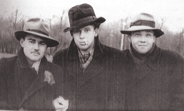
The pinnacle of my engagement with the Mining Institute was my election as an Honorary Professor of St. Petersburg Mining University in 2000.
Viktor A. Glebovitsky (RAS Corresponding Member), a fellow student of mine, wrote in his memoirs, “Back at the institute, he [Kolya Dobretsov] was a great guy: cheerful, athletic, and prone to falling in love. He had a high opinion of himself; yet he harbored certain insecurities and was easily hurt. Even as a student, Kolya used to say that he would surely become either a minister or an academician [I do not recall this myself. Note by N.D.]… It is very difficult, sometimes impossible, to hold a scientific discussion with him. Not because he is always right, but because he never listens to people he is talking to. He as if filters all your remarks through some sort of mental sieve. It is often unclear why he takes in one thing and fails to hear another. But he is certainly a kind-hearted person always ready to lend a hand…”
It is always useful to have a smart, attentive person hold up a mirror to you.
From our group of 25 students, 3 became members of the Academy of Sciences and about 10 earned a doctor-of-science degree. Not a bad result.
“Dobretsov tilled this field”
The Institute gave me athletic discipline, solid training in field geology, and a wealth of ideas regarding volcanism, granitic magmatism, and ore formation – the ideas that largely transformed after I met Academician Vladimir S. Sobolev, who was and still is my “father-in-science.”
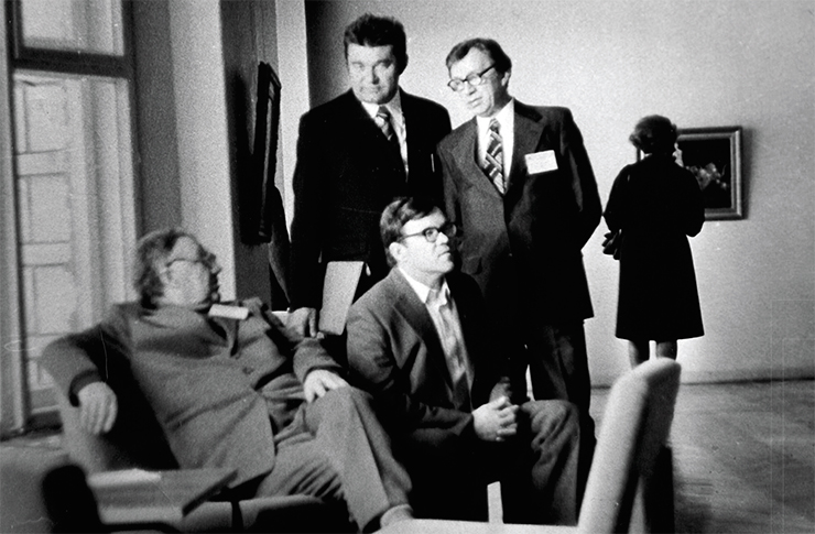
We met in Leningrad, at the Astoria Hotel, after he received a letter from my grandfather Kell, who was once his supervisor during his practice in the Urals. He wrote: “Volodya, have a look at my grandson. Perhaps, he will be of some use.” Sobolev handed me a copy of a research paper in English (“The problem of jadeite” by H. Yoder) and said: “How about you take the problem of jadeite?” Right at that time I was working in the industry as the head of a party; I was reading and writing reports, rarely research papers; I had forgotten all my English and heard about the jadeite problem for the first time. This is how I delved into the problems of mineralogy.
I had to catch up with Sobolev’s people in the field of physicochemical petrology. However, I drew upon my experience as a geologist, bringing back from expeditions detailed maps of the places where I worked as well as rock and mineral collections.
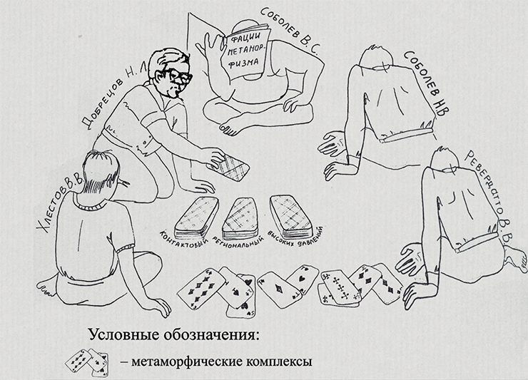
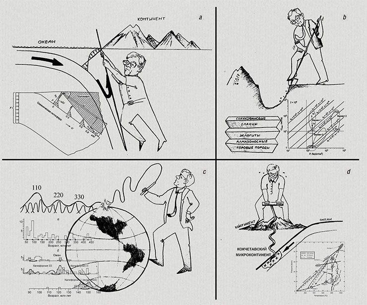
The main outcome of my work under Sobolev’s guidance was The Map of Metamorphic Facies of the Soviet Union (1965) and the four-volume monograph Facies of Metamorphism (1970–1974). The map of metamorphic facies – the first one for a territory as vast as the Soviet Union – was my initiative. It spurred the development of a series of Russian and international metamorphic maps (such as Metamorphic Belts of the Soviet Union (1971), International Maps of Metamorphic Facies Distribution in Europe (1970) and Asia (1974)), in which I took part as well. This topic (specifically the maps) was playfully depicted in a humorous sketch by Evgeny V. Sklyarov on the occasion of our receiving the Lenin Prize in 1976.
The monographs summarized a huge amount of material on regional and contact metamorphism in the Soviet Union and around the world. So Sklyarov wrote in his humorous commentary:
“Eventually, will there be a single problem in geology not bearing the label: ‘Dobretsov tilled this field’?” “In the metamorphic field, there is a special garden whose digging and cultivation was initiated by Dobretsov and where he remains the chief gardener – this is metamorphism and tectonics.”
Sklyarov was one of my first students, a beloved and talented one; now he is an informal leader of the Institute of the Earth’s Crust, SB RAS (Irkutsk).
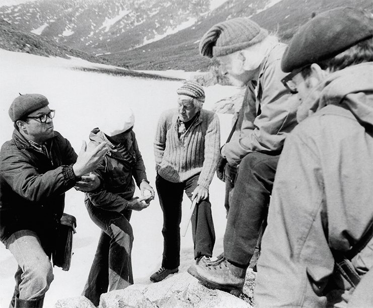
In addition to metamorphism, my early research also focused on ophiolites, i. e., relics of ancient oceanic crust. I began to study them vigorously after joining the Working Subgroup of Commission IX, led by L. P. Zonenshain (this commission oversaw cooperation efforts among the academies of socialist countries and, like the socialist countries themselves, existed until 1990), and the International Ophiolite Commission, co-chaired by the Belgian professor Robert Coleman (this commission was active until the late 1980s).
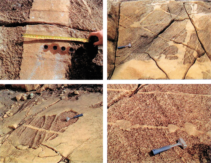
In this photograph from 1979 (now part of the archives), Galina N. Savelieva and I are explaining the internal architecture of the ultramafic section within ophiolites of the Voikar–Synya Massif (Polar Urals) to participants of an international field trip. They clearly reveal the banding of harzburgites and the veins and veinlets of dunites. Between 1977 and 1981, I attributed their origin to the percolation of a mafic–ultramafic melt, which dissolved (or washed out) pyroxenes from the mantle substrate, leaving behind only highly magnesian olivine and spinel as restites. I termed this process of “percolation via dissolution” – like water in a sugar cube – as paratexis, distinguishing it from anatexis, i. e., the partial melting of gneisses without significant displacement. In those days, when everyone was fascinated with metasomatism, these ideas faced strong opposition; it was only 25–30 years later that they gained support and further development in Coleman’s works (Coleman et al., 2002, 2005) and in a 2009 paper by V. G. Batanova and G. N. Savelieva. The latter reads: “…in his parataxis model, Dobretsov (1981) assumed that during the melt percolation through the mantle, melting is initiated along the grain boundaries at the front of the migrating melt, and the latter works its way <…> At both initial and regressive stages, the melt migration is localized in a few separated flows leading to the formation of tubular bodies and dunite network.”
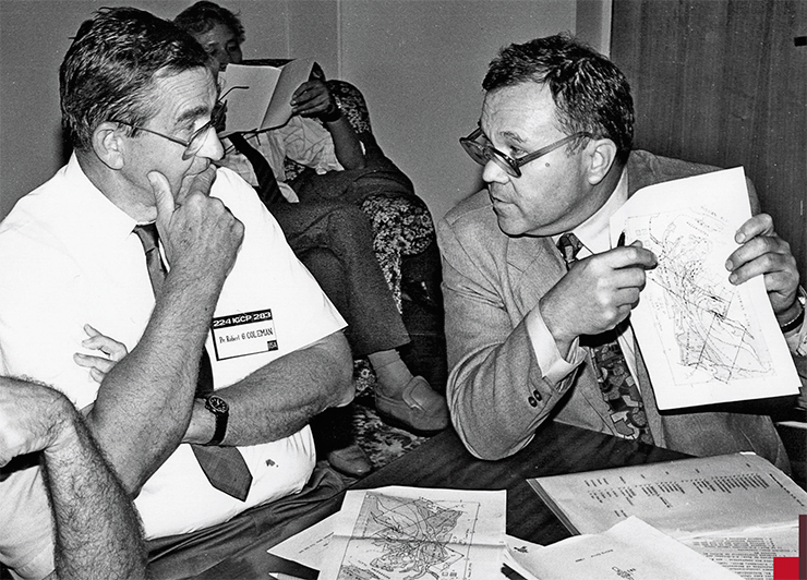
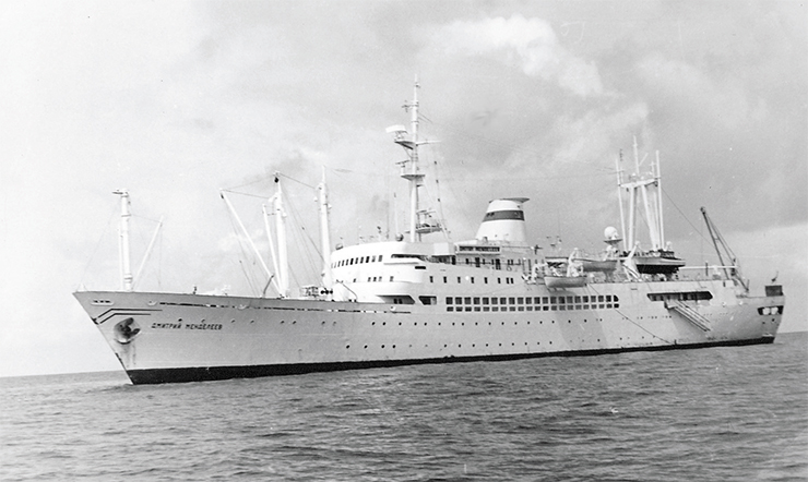
I worked with Bob Coleman (everyone, professors and students alike, called him Bob) for many years in various regions. We were together on my first international voyage aboard the research vessel Dmitry Mendeleev, where we successfully conducted dredging operations near the Mariana Trench and discovered unusual rock types resembling melted pyroxenites. We initially named them marianites but later changed this term to boninites.
Bob himself prepared thin sections from the samples using the grinding machine. He called himself a “second-class engineer” as our “first-class” grinder had been barred from the voyage due to a family scandal (in those days, individuals deemed “morally loose” could not travel abroad). The thin sections were excellent; the glass revealed numerous orthopyroxene crystals containing mineral relicts that I identified as clinoenstatite by measuring the coordinates of its polysynthetic twins on a Fedorov stage. Surprisingly, there was a Fedorov stage on the ship and no one else knew how to use it – a skill that, alas, modern students also lack. Together with Coleman, Anatoly Ya. Sharas’kin, Nikolai V. Sobolev, and others, we prepared and published the book Geology of the Philippine Sea Floor (1980) and a series of papers on boninites and marianites, including a joint presentation at the 1978 Ophiolite Symposium held in Nicosia, Cyprus.
Tolya Sharas’kin, Bob Coleman, the voyage aboard Dmitry Mendeleev, boninites–marianites… All this sparked my deep interest in subduction-related magmatism, a subject I continue to investigate to this day.
“You shouldn’t let academicians to the bottom of the ocean”
The year 1976 began happily but ended in tragedy. We received the Lenin Prize – hurrah! Inna, the children, and I moved into a semidetached house and were making it a home. In early May, just as I was preparing to leave for Vladivostok and from there to embark on a voyage aboard Dmitry Mendeleev, Inna showed the first symptoms of her illness. In mid-June, while at sea, I received a radio message about Inna’s grave condition and her impending surgery. It was a rapidly progressing cancer. Inna passed away following the surgery in late June. I was only able to disembark five days later in Singapore (Hong Kong was closer, but they denied entry to the “Russian spy ship”). I did not make it back in time for the funeral. No words can describe what followed…
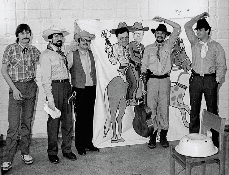
The year 1980 ushered in a new chapter of my life, namely, the Buryat period, which proved to be among the most pivotal and rewarding. For ten years, I was the director of a small yet cohesive and productive research team capable of tackling world-class challenges. During this time, I was elected a Corresponding Member and subsequently a Full Member of the Academy of Sciences, and for the final two years, I chaired the Presidium of the Buryat Scientific Center.
It was a time of intensive fieldwork, including expeditions using all-terrain vehicles in the Eastern Sayan Mountains, during which we identified and described tectonic nappes of Neoproterozoic ophiolites (including the Dundzhugur ophiolites, among the oldest in the world, one billion years old and boninite dikes and nappes). I also worked much more with ore deposits, such as gold deposits in the Eastern Sayan, the Kholodnaya polymetallic deposit in the Northern Baikal region, the Dzhida tungsten deposit, etc.
Yet my greatest blessing was meeting Lyuba, who became my wife and gave me over 33 years of happiness. We went on field expeditions together, swam in Lake Baikal at night, raised our children, and hosted guests: Bob Coleman, Andrei Trofimuk, Valentin Koptyug.
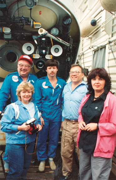
One of the most memorable episodes at the end of my Buryat chapter was an Atlantic voyage aboard Akademik Mstislav Keldysh. Lyuba and I set off in the summer of 1989. During that voyage, I had the rarest opportunity of diving to the floor of the Atlantic Ocean at a depth of 5050 meters, an experience made possible by the Mir deep-sea submersibles.
We were working on the Atlantic seafloor between Spain and the Mid-Atlantic Ridge (MAR), specifically at Palmer Ridge and King’s Trough, where there is an exposed section of oceanic crust about 50 million years old. After descending to the Atlantic floor in the Mir submersible, I took a photograph using a camera mounted above the viewport, which offered a clear view of slightly tilted, parallel basaltic dikes. These parallel dikes, along with the gabbro and pillow lavas of oceanic basalts, bore a striking resemblance to the ancient oceanic ophiolite sequences I had observed in the Polar Urals, Western and Eastern Sayan Mountains, Koryakia (Kamchatka), and elsewhere. I recall that in 1972, at an outcrop along the Left Koyard stream in the Kurtushiba Range (Western Sayan), I saw similar parallel diabase dike bodies and realized that was a dike sheet complex, which meant proof of seafloor spreading! I was so overjoyed that I danced, right there at the outcrop, a mix of Lezginka and boogie-woogie.
My dive to the Atlantic seafloor nearly ended in a tragedy. The hydraulic control system failed. The manipulator arms, which we used to collect samples and lit the seabed during filming, had been overloaded with extra lights, as the expedition was scheduled to continue near Bermuda with a National Geographic team, a trip that required more powerful lighting. The hydraulic lines burst due to overstrain; we saw streams of oil droplets rising up in front of the viewport. The submersible lost control and nosed into the silt at an angle of nearly 45 degrees. It took four hours to activate the backup hydraulic system (we had struggled to find the information that the backup system required the main engine to be running – it was buried in a footnote to the manual, printed in tiny type).
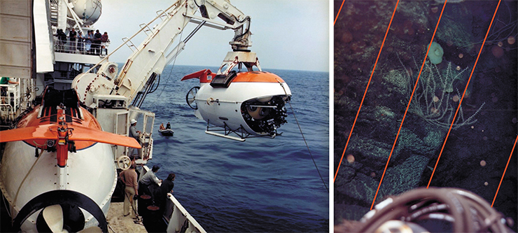
The people on the ship took our delay easy at first. But then night fell and everyone began scurrying about in alarm. Lyuba felt faint. Fortunately, by that time we had already surfaced in emergency mode. She was able to joke through her tears, “You shouldn’t let academicians to the bottom of the ocean.”
After completing operations at the test site, the ship arrived in Washington, where we participated in the International Geological Congress. The ship was moored on the Potomac River in the Washington suburbs; scientists and businesspeople paid us many visits, taking a keen interest in the Mir submersible and our findings. Among our visitors was Max Pitcher, one of the wealthiest men in the United States, the owner of ARCO, a company involved in oil operations in Alaska. In return, he hosted a grand reception for Russian petroleum scientists, to which he invited both Lyuba and me. Subsequently, I learned that, during the event, the oil tycoon had proposed to my wife. Luckily I was not there for that, or an international scandal could have blown up.
Lyuba was always at the heart of things. Our home was a place for informal meetings of the chairmen of the SB RAS regional scientific centers. There always was plenty of singing, drinking, and joking, but important issues, too, were discussed. Lyuba easily found common ground with everyone, from academicians to drivers we worked with in the field, in Moscow, in Novosibirsk, with doctors and nurses at the hospital…
Now, the two women I loved – Inna and Lyuba – lie side by side at the cemetery. They never even met while they were alive. I come there and speak to both of them… Love is the only sound idea in the countless theories of the meaning of life.
“Your glory will be mine too”
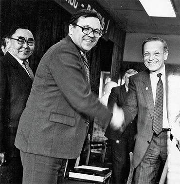
As I said, my “father-in-science” was Academician V. S. Sobolev. If I make a list of my colleagues, coauthors, and students – and, thus, of scientific ideas we worked on – it will be as long as several pages.
Of particular importance to me are the studies at the unique Kokchetav complex in Northern Kazakhstan, where we first discovered diamond crystals in metamorphic rocks. This research can be divided into three distinct periods: (1) the early 1970s: the work with Academician Sobolev, O. M. Rozen (Moscow), and specialists from Almaty. (2) The 1990s: collaborative projects with Coleman, Ernst, Koen Theunissen, Shigenori Maruyama, and other Belgian and Japanese colleagues. Together with our Belgian colleagues, we organized an international project to study the diamond-bearing rocks of the Kokchetav complex. (3) The last decade: new research methods applied in collaboration with Vladislav S. Shatsky, Mikhail M. Buslov, and Anatoly Korsakov. Vladik Shatsky and Misha Buslov were my students, and we toiled long and fruitfully side by side on problems well beyond the Kokchetav Belt.
In the different periods I had different ideas of the magnitude and mechanism of high pressure required to form diamond- and coesite-bearing rocks. Early on, we assumed tectonic overpressures of up to 35–40 kbar; during the second period, the estimates rose to 45–50 kbar, as they depended on the depth of the subduction zone from which the rocks were exhumed. Today, however, based on melt inclusions in potassic clinopyroxene and the discovery of new minerals such as cymrite, kokchetavite, etc., we believe that the pressure reached 65–70 kbar.
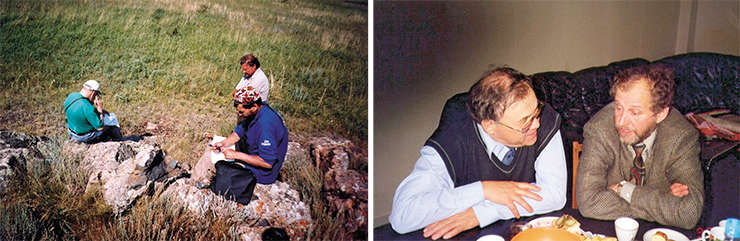
Speaking about my joint projects with colleagues and students, I must say that it was Academicians Koptyug and Trofimuk who taught me teamwork. Koptyug was a passionate essay writer and a champion of true democracy. It was he who suggested (and this initiative was put to practice) that representatives from the various institutes be included – with equal rights and an equal number of votes – in the SB RAS General Assembly, which elected by secret ballot the SB RAS leadership and institute directors. Subsequently, institute representatives were also included in the RAS General Assembly, although at a ratio of only one to three. Yet now, Andrei A. Fursenko claims that the RAS reform was launched precisely to increase the governance participation of rank-and-file scientists. Does removing them mean strengthening their role?
For 30 years, Trofimuk headed the Institute of Geology and Geophysics, which he himself founded. At the very beginning of his career as director, he told his colleagues: “I am not the best among you, but fate has decreed that I become your director. Do your work and your glory will be mine too” (from the memoirs of Academician Boris S. Sokolov). Trofimuk, like me, was a passionate fisherman, and we met many times on ice during winter fishing. One could not do it without drinking, and Trofimuk always said: “Only dogs eat fish without vodka.”
When he handed over the reins of the institute to me in late 1988, he never interfered in my work. However, he regularly spoke at the meetings of the Academic Council on fundamental scientific and organizational issues. He delivered a stirring and impassioned speech in my support at the 1997 General Meeting, singling me out from among five candidates as the principal successor to Koptyug’s legacy.
Over the years, I have met a great many people, and not only scientists. I have always been a staunch advocate of developing scientific ties with China and Korea as well as Japan. I became friends with Prof. Lu Yongxiang, President of the Chinese Academy of Sciences (CAS). Whenever I visited Beijing, I always made time for a friendly meeting with him. He even traveled specifically to Novosibirsk to sign a separate, formal cooperation agreement between the CAS and the Siberian Branch of the RAS, although there had been a general cooperation agreement with the RAS.
The friendly relations fostered the development of multifaceted cooperation with the CAS: a Russian–Chinese center for near-space research and a joint technology park in Changchun. The CAS became a co-founder of the Baikal International Center; numerous agreements were signed between Chinese institutes and firms and various Russian institutes, including the Institute of Theoretical and Applied Mechanics and Institute of Strength Physics and Materials Science. International programs to combat desertification were launched at the initiative of the Mongolian and Chinese Academies of Sciences. Of all these initiatives, only the cooperation between Novosibirsk State University and the universities of Harbin has endured and continues to develop.
A tremendous amount of work went into establishing the AASA (Association of Academies of Sciences in Asia). An organizational meeting attended by representatives from 13 Asian academies of sciences took place in Irkutsk in 2000; the RAS was represented by RAS Vice-Presidents: Gennady A. Mesyats and myself. Currently, the RAS ceased to participate in all programs of the AASA and the Association of Academies of Sciences of the Third World due to a lack of funds and enthusiasts.
As to “nonscientific” recollections, I would like to tell about my meetings with Russian Presidents Boris Yeltsin and Vladimir Putin. We received Yeltsin in Akademgorodok, together with Koptyug. It was shortly after Yeltsin was elected the first president of the Russian Federation. After visiting our institute’s geology museum, he answered a few questions from people in the crowd; we even discussed volleyball. We managed to get him to sign a decree “On the Development of the Siberian Branch”; however, much like almost all his other promises, most of its provisions went unfulfilled. Despite a few positive aspects of Yeltsin’s first time in office, my overall impression remains a dismal one.
My first meetings with Vladimir Putin left a wonderful impression, especially at the start, given the contrast with Yeltsin. He took a lively interest in my presentation at the House of Scientists in Akademgorodok regarding the need for a development strategy for Siberia and Russia as a whole. At a roundtable discussion at the Budker Institute of Nuclear Physics (INP), he listened enthusiastically to scientists’ remarks, showed great interest in an exhibition of SB RAS innovations, and even offered critical observations on the production of night-vision devices. Hopes pinned on Putin grew and solidified following a meeting of leading RAS scientists in Dagomys and a subsequent luncheon aboard a ship. I still have a photograph showing Putin alongside myself, Zhores Alferov, and Evgeny M. Primakov, the initiator of that meeting. Many concrete proposals and directives were voiced during the first meeting of the Commission on Science and Technology, which Putin chaired in 2002 in the Kremlin’s Catherine Hall. He tasked me with delivering the inaugural report on the development of science in the regions. Unfortunately, my proposal to develop akademgorodoks (science towns integrated with research institutes) and establish technology parks was not supported at the time; instead, a decision was made to set up and develop naukograds (designated science cities), an initiative that ultimately proved to be a futile endeavor.
Another remarkable person I was lucky to meet was Patriarch Alexius II. During a luncheon at the Fireplace Hall of the House of Scientists, I proposed a toast with red wine to the occasion and to Russia, and he unexpectedly joined in. A discussion ensued regarding the roles of science and religion. I recall saying that, for the time being, we might have been considered allies, as religious morality was preferable to a complete lack of morality. Alexius impressed me deeply with his erudition and historical knowledge. On behalf of the SB RAS, I presented him with books on the history of Siberia’s indigenous peoples; he, in turn, presented me with an icon, which Lyuba would cherish like the apple of her eye…
Also, I cannot but mention the team I worked with at the SB RAS Presidium between 1997 and 2008. It was a team of like-minded people, with each member responsible for their own specific areas of work. Together, we proposed and supported new ideas, such as interdisciplinary integration projects, the establishment of shared-use research facilities, and the establishment and development of the technopark.
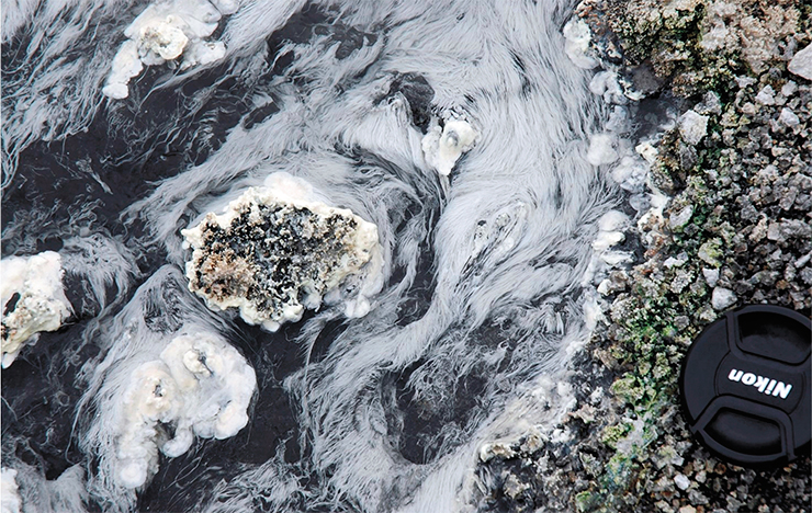
Concluding my essay, I would like to talk about yet another scientific idea that captivated me in recent years. The evolution of the biosphere is influenced not only by climatic but also endogenous geological factors, such as the catastrophic plume-related volcanic eruptions at the end of the Cretaceous, at the Permian boundary (Siberian Traps), at the end of the Neoproterozoic, and at the end of the Archean. Fifteen scientists from six institutes of the SB RAS, two Moscow institutes, and one institute of the Far Eastern Branch of the RAS took part in preparing a paper on evolutionary research in the Uzon caldera in Kamchatka. The authors include geochemists S. M. Zhmodik and E. V. Lazareva; paleontologist A. S. Rozanov; chemists O. P. Taran, O. L. Ogorodnikova, and O. V. Shuvaeva; microbiologists A. V. Bryanskaya and V. V. Morozov.
The humanity Homo sapiens has another 100 million years unless it destroys itself sooner. The study demonstrated the cumulative biospheric contribution of various groups of organisms with three peaks (approximately 1.7, 1.0, and 0.5 billion years ago), driven primarily by the evolution of surface temperature. Major surface temperature fluctuations associated with glaciations have been recorded since 0.8 billion years ago and will continue for another 0.8 billion years, after which higher organisms will die out. After another 1.2 billion years simple eukaryotes will disappear, followed by prokaryotes and all life forms in yet another 1.6 billion years. This latter conclusion is based on astrophysical projections regarding the Sun’s transformation into a large red star.
In conclusion, I would like to mention another scientific project that is important to me. Together with my student Dmitry Metelkin, a researcher at the Trofimuk Institute of Petroleum Geology and Geophysics, SB RAS, and the Laboratory of Geodynamics and Paleomagnetism of the Central and Eastern Arctic at Novosibirsk State University, we are finalizing a new edition of the textbook Fundamentals of Tectonics and Geodynamics.
Its core idea is that the Earth’s new global geodynamics can be understood only from the perspective of an evolving Earth, taking into account the periodicity (cyclicity) of endogenous processes, which comprise cycles of several orders. In line with this idea, the textbook includes the following sections: (a) plate tectonics, driven by convection in the upper and lower mantle and the interaction between the asthenosphere and the lithosphere; (b) tectonics of plumes originating at the core–mantle boundary; and (c) cosmic factors associated the Solar System’s evolution and climate variations.
I am certain that the ideas on global geodynamics, plume- and subduction-related volcanism, and biosphere evolution will endure and flourish further, carried forward by my students and successors.
The editors of SCIENCE First Hand thank A. N. Dobretsov, Corresponding Member E. V. Sklyarov, and Dr. I. Yu. Kulakov for their support and assistance in preparing this publication
: 31 Oct 2026 , Academician Dobretsov: On the Crest of the Plume , volume 72,
N2